Image copyright Nasa Planetary Photojournal
| ||
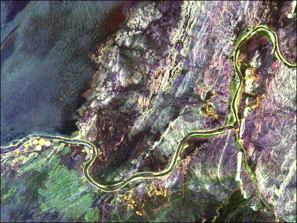
| A radar image of part of the Richtersveld National Park and Orange River in the Northern Cape. The river forms the boundary between South Africa and Namibia to the north. This is an active diamond-mining area, with the stones washed downstream from the Kimberley area millions of years ago. A mine, shown in yellow, is on the southern bank of the river. The small circular areas to the west are fields of a large ostrich farm, watered with centre-pivot irrigation. Image copyright Nasa Planetary Photojournal
| ||
| back to gallery |